


More about: 5 Best Hikes in Lanzarote
At the northeastern end of the Canary Islands, the island of Lanzarote stands out as one of the most important in the archipelago. Like all the Canary Islands, Lanzarote has many things to see and do, including hiking, as it is a volcanic island with a very complicated topography that is ideal for hiking activities. Many ups and downs, as well as charming landscapes, await you in Lanzarote.
It doesn't matter if you have a lot of experience or very little; in Lanzarote there are routes for all levels of difficulty, so you won't be able to turn down any of the options. Close to the sea, climbing mountains, with plenty of exercise and relaxation: the hiking trails in Lanzarote are truly phenomenal. Are you ready to discover them?
1. Hiking tour of southeastern Lanzarote: from Playa Quemada to Playa Blanca
Lanzarote is an oval-shaped island with flattened ends. When you look at it on a map, as with most of the Canary Islands, many people think it would be perfect to walk around the island. Although this is technically possible, we are talking about nearly 200 kilometers, so I suggest doing it in sections, starting with the southeastern section between Playa Quemada and Playa Blanca, skirting the Los Ajaches Natural Monument, a protected area with conservation regulations.
This is a 21-kilometer route and is moderately difficult because, although there are no major ascents or descents, the sun is harsh and it is not a short walk. In addition, although most of the route is well marked, it sometimes runs along the coast. If you go on your own, I recommend swimming at the different beaches you will see, such as Playa del Pozo, La Casa, and Playa del Papagayo. You will also find the San Marcial de Rubicón wells and their archaeological site very attractive.
Just before reaching Playa Blanca, you will come across the Castillo de las Coloradas. On the beach, I recommend sitting down to eat at a seafood restaurant or checking out all the options for some of the best boat tours from here. As the route is not always marked, I recommend doing it in a group.
Practical information
- Level of difficulty: Moderate
- Length: about 21 kilometers
- What is the route like: most of the sections are marked, but once you enter the beaches, this is no longer the case, so it is not recommended for groups of beginners without a guide.
2. Route from Playa Quemada to the capital

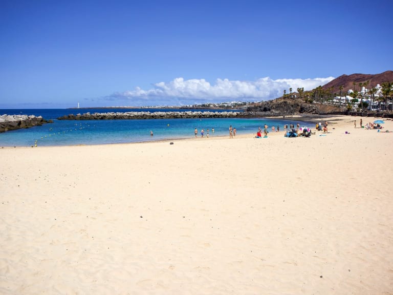
When you arrive at Playa Quemada, you'll realize that it's one of the most fantastic places on the entire island. It's a practically untouched beach with very dark sand, similar to the earth, and only a few white houses in the surrounding area. If you took the coastal route, this beach is halfway between Playa Blanca, at the southern tip, and Arrecife, the capital, so today I suggest you go from Playa Quemada to Arrecife, a city that is well worth visiting.
In total, it is about 20 kilometers along the coast. Although it is quite a long route, it is actually very easy, as it follows the coastline without any major irregularities. You do need to make sure that the tide is calm, as strong tides can make the route along the beaches difficult. You will pass by the best beaches in Lanzarote, as well as Puerto del Carmen and Puerto Calero, and following the coastline, you will arrive in Arrecife in about five hours.
Depending on the time of day you go, I suggest wearing a loose-fitting long-sleeved T-shirt to protect yourself from the sun and taking plenty of water and food, as it is a fairly inhospitable route.
Practical information
- Level of difficulty: Low
- Length: about 20 kilometers
- What is the route like? The route follows the coastline, so you won't need any signposts. It is important to keep an eye on the tide.
Traveler tip
On routes like this, the sun can be harsh. That's why you need to have plenty of sunscreen and even an umbrella to try to protect yourself. Remember that this is an excursion to an inhospitable place, so you must be prepared to keep walking.
3. Tour of the Timanfaya Coast
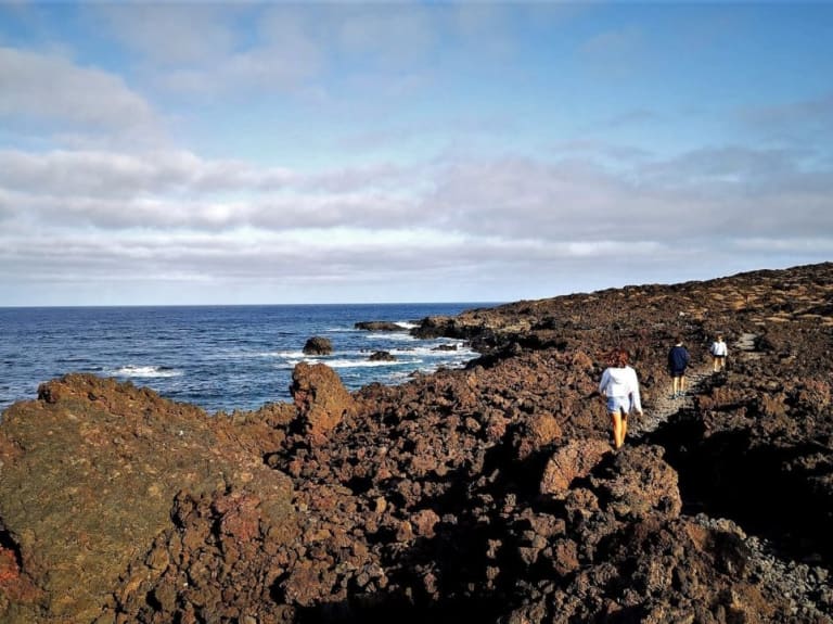
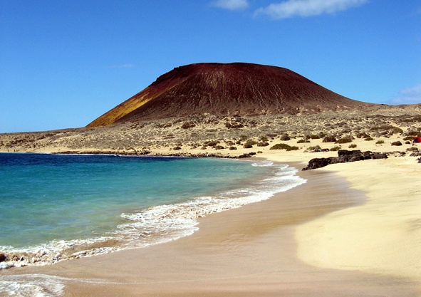
On the west side of Lanzarote is Timanfaya National Park, one of the most important in Spain, which preserves the volcanic origin of the island, with more than 25 volcanoes. Behind this chain of volcanoes is a small coastal strip that is well worth walking from end to end.
This trail is easy to walk, as it is about 5 kilometers long with no major slopes. It is the only trail in the national park that can be done without a guide. In general, you start from El Golfo, where there are different hostels and you can buy food. Once there, walk north to El Paso, a phenomenal beach where you can spend the rest of the day.
Keep in mind that you are in a national park, so you will have to carry any trash with you. In addition, it is a totally protected environment, so the shops you will find are very basic. This is a perfect trail for tourists who want to disconnect and watch the sunset, as the sun sets right in front of this coast.
Practical information
- Difficulty level: Low
- Length: about 5 kilometers
- What is the trail like: The trail is marked by the national park itself. The route requires good shoes and sun protection.
4. Hiking trail in the north, between Costa Teguise and Arrieta

Although the south of Lanzarote always attracts the most attention, the north coast also has many attractions, especially if you walk along the coast between Costa Teguise and Arrieta. I suggest you head to Costa Teguise, a very popular spot at the southern end of this route, and from there start walking for about four hours until you reach Arrieta, very close to Punta Mujeres.
To get to Teguise, you can take buses from Arrecife, and you can also return from Arrieta, so there won't be any problems. My advice is to take this route at sunrise, so you can watch the sun come up on your right and say good morning.
This trail is well marked and does not run directly along the coast but to one side, as this area of the island has many cliffs, although the slopes are not difficult. Also keep in mind that, apart from Los Cocoteros, there is no other population in this area, so the trail is quite isolated. Bring everything you need for the hike.
Practical information
- Difficulty level: Moderate
- Length: approximately 18 kilometers
- What is the trail like: The trail is marked and runs close to the coast, but not on it. The cliffs are very close, and you can stop at the beaches.
5. Circular tour of the volcano crater

We continue with one of the best tours of Timanfaya National Park, but now quite far from the coast. Would you like to hike on top of a volcano? Don't worry: it's quite safe. The Caldera de los Cuervos is a crater of a volcano with extremely arid vegetation located within this national park, and it is possible to approach the edge and even descend into the crater.
In total, the trail around the crater is no more than 4 kilometers long. The most difficult part is climbing the mountain, but it is a fairly easy climb, and after that, it is a very contemplative walk. Due to its ease, it is a route that can be done by the whole family, and if you are looking for activities to do with children in Lanzarote, then you can include it on your list.
The parking lot is quite close, and in total, the entire excursion can last about an hour and a half, so it is a short trip that will allow you to do other things during the day. You have to be careful on the way because the wind is extremely strong, but it's the perfect place to take all the photos you want.
Practical information
- Difficulty level: Easy
- Length: just over 4 kilometers.
- What is the trail like: very easy, you just have to climb up to the crater and walk around it.
How long are the hiking trails in Lanzarote?

The great thing about hiking in Lanzarote is that the island offers all kinds of options for different routes, so the duration will vary depending on your routine. There are professional hikers who even take on the challenge of walking around the island, but in general you can take long routes, lasting around seven or eight hours, as well as shorter ones that can last just over an hour.
It is important not to get carried away and to calculate the distances. For example, a 20-kilometer hike can take seven hours, but you will also have to travel from one point to another, so you will need to calculate the duration of your return to the hotel depending on the means of transport you use and, if applicable, your budget. For this, I recommend the Intercity Bus, which is a public bus network, or guaguas as they are known in the Canary Islands.
You should also bear in mind that if you are traveling in a group, the duration will be that of the group. Although the group will eventually adapt to a pace that suits most people, it is important to know that if you are faster or slower, you will have to adapt and be comfortable throughout the tour, which means being patient with those who are slower and waiting a little longer for those who are faster.
What will I see on these hiking trails?

Lanzarote is a truly beautiful island, because it combines the most arid mountains with the most crystal-clear beaches. It is an island that ranges from the rustic to the pure, and when you walk along the different hiking trails, you will realize everything that this implies. Many of the trails run alongside the sea, so you can always keep one eye on the ocean and the other on the island's land.
However, there is much more to see. The landscapes change quite a bit. For example, on the route between Playa Quemada and Arrecife, you will notice how the landscape is extremely arid, almost desert-like, and the coast becomes rocky and dark. For this reason, Lanzarote has been compared to the surface of Mars. But when you travel around the north of the island or Playa Blanca in the south, you will see how the sea becomes even calmer and the vegetation a little greener.
And what about the parks? Well, Timanfaya is the most important one, where you can walk through a series of volcanic craters that make up a truly unique landscape. All this makes Lanzarote a diverse vacation destination, especially for walking, because there will always be something new to admire.
What are the advantages of hiring a hiking guide vs. doing it on my own?

A common question among people who are new to hiking is whether they can hike alone, with their family, or if they should hire a guide. The truth is that it all depends, but there are always options in between. My advice is that if you feel comfortable and the trail is well marked, then there is no problem going on your own, as long as you have a GPS or at least a compass that you know how to use in case of emergency.
The problem arises on trails that are not fully marked or that are too intertwined with the coastline. In this case, it can be easy to get lost, so it is necessary to go with an expert guide or someone who has already done the route. Guides can provide you with the best information about the route you are taking and, therefore, give you added value, as you will not only be exercising but also learning about the area.
There are also intermediate options, as there are hiking groups in Lanzarote who will be happy to welcome you and add you to their schedule, even if you are only staying for a few days. In this case, the costs are considerably reduced and you don't need a guide to successfully reach the final destination of your chosen route.
Comparison of the different options
- Lanzarote in the southeast: from Playa Quemada to Playa Blanca
- Level of difficulty: moderate
- Length: approximately 21 kilometers
- What the route is like: most of the sections are marked, but this becomes less clear on the coast
- From Playa Quemada to the capital
- Level of difficulty: low
- Length: approximately 20 kilometers
- What is the trail like: it follows the coastline, so no markings are necessary.
- Tour of the Timanfaya coastline
- Level of difficulty: low
- Length: about 5 kilometers
- What is the route like: the route is marked by the national park itself.
- To the north, along the Teguise-Arrieta coast
- Level of difficulty: moderate
- Length: approximately 18 kilometers
- What is the trail like: the trail is marked and runs close to the coast, but not on it, rather on the side of the cliffs.
- Circular route around the volcano crater
- Level of difficulty: easy
- Length: just over 4 kilometers
- What is the trail like: very easy, you just have to climb up to the crater and walk around it.